Harnessing the Power of Drone LiDAR for Land Surveying: Insights with Harrison Knoll
with Harrison Knoll, CEO of Rock Robotic
In a world where technology is rapidly transforming traditional practices, Harrison Knoll stands at the forefront of geospatial innovation. As the CEO of ROCK Robotic and the face behind Indiana Drones on YouTube, Knoll has been an ardent advocate for the advantages of drone LiDAR in land surveying. In this exclusive interview, we delve into the superiority of drone LiDAR over conventional surveying methods, explore the common challenges faced in its application, analyze its cost-effectiveness, and shed light on practical examples where drone LiDAR has revolutionized land surveying. Join us as we journey through this fascinating discourse with one of the industry's most visionary leaders.
Table of Contents
What are the key factors or specifications for evaluating drone LiDAR equipment for land surveying?
- Accuracy: This is the most critical factor. The system should provide high-precision data, with
accuracy down to a few centimeters. - Point Density: The more points per square meter the LiDAR system can capture, the more
detailed your data will be. - Range: The maximum distance the LiDAR sensor can measure effectively is also important. A
longer range allows the drone to fly at a higher altitude, covering more ground in each flight. - Weight and Size: The LiDAR system should be lightweight and compact enough to be mounted
on a drone without affecting its flight performance. - Ease of Use: The system should be user-friendly, with intuitive software for data processing and
analysis. - Support and Training: Good customer support and training resources are essential to help you
get the most out of your LiDAR system. - Price: While you want a system that delivers high-quality data, it also needs to fit within your
budget.
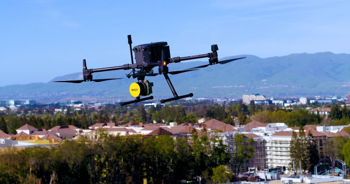
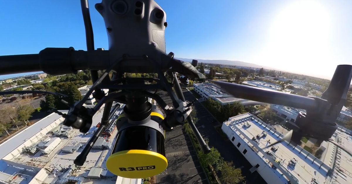
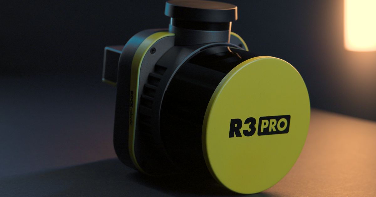
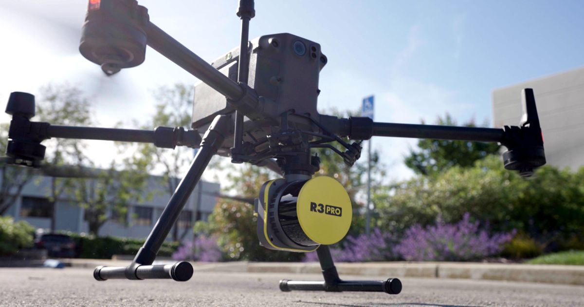
The ROCK R3 Pro LiDAR system excels in all these areas, making it an excellent choice for land
surveying. It offers high accuracy, a high point density, a long range, and it's lightweight and compact.
Plus, it comes with ROCK Cloud for easy data processing and analysis, and we offer excellent customer
support and training.
What advantages do drone LiDAR systems offer over traditional surveying methods?
- Speed: Drone LiDAR can cover large areas much faster than traditional methods. What could
take days or even weeks with a ground survey can be done in a matter of hours with a drone. - Safety: Drones can safely survey hazardous or difficult-to-reach areas without putting surveyors
at risk. - Data Density: LiDAR systems can capture hundreds of thousands of points per second, resulting
in a much more detailed and accurate representation of the terrain. - Cost-Effective: While the upfront cost of a drone LiDAR system may be higher, the time and labor
savings make it a cost-effective solution in the long run. - Versatility: Drone LiDAR can be used in a wide range of applications, from land surveying and
construction to forestry and environmental research.
The ROCK R3 Pro LiDAR system and ROCK Cloud offer all these advantages and more. With high
accuracy, high point density, and user-friendly software, they make it easy to get the high-quality data you
need, fast.
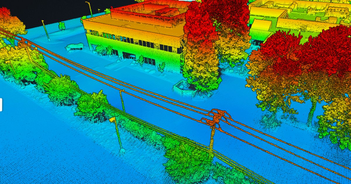
Can you elaborate on the level of accuracy that drone LiDAR technology can achieve in land surveying, and how it compares to more traditional methods?
ROCK R3 Pro LiDAR system can achieve impressive levels of accuracy. We're talking about vertical
accuracy down to 3 cm and horizontal accuracy down to 5 cm. This level of precision is achieved through
advanced sensor technology and sophisticated data processing algorithms.
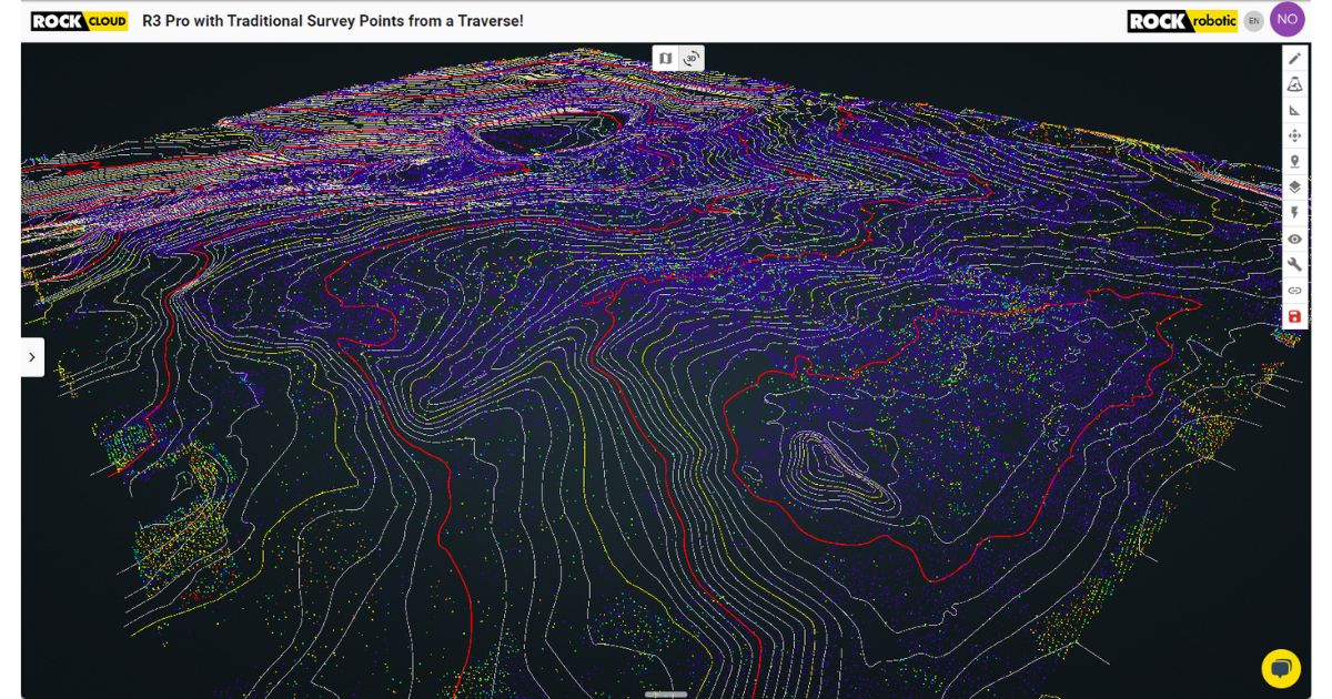
In comparison, traditional land surveying methods, such as total stations or GPS, can also achieve high
levels of accuracy. However, the key difference lies in the efficiency and data density. Traditional methods
require manual, point-by-point data collection, which can be time-consuming, may not capture the full
complexity of the terrain and can be very dangerous.
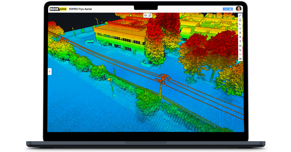
On the other hand, drone LiDAR can capture hundreds of millions of data points per second, providing a
much more detailed and comprehensive 3D representation of the land. This not only increases the quality
of the data but also significantly reduces the time spent in the field.
Moreover, with ROCK Cloud, you can easily process and analyze your LiDAR data, further enhancing the
accuracy and usefulness of the information.
What are some common challenges or issues that users might face when using drone LiDAR technology for land surveying, and what are your suggestions for overcoming these challenges?
- Learning Curve: Drone LiDAR technology and the associated software can be complex. However,
at ROCK Robotic, we offer comprehensive training and support to help you get up to speed
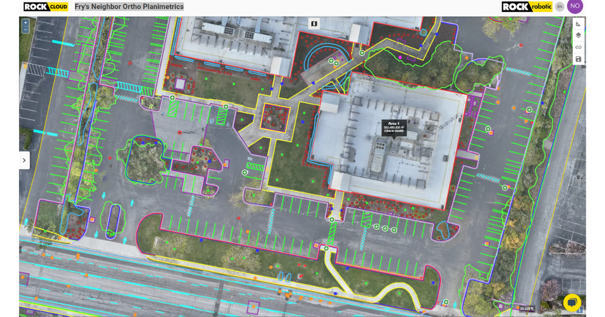
quickly. Our ROCK Desktop and ROCK Cloud platforms are also designed to be user-friendly. - Data Management: LiDAR generates a large amount of data, which can be challenging to
manage and process. Our solution to this is ROCK Cloud, which provides a unified platform for
processing, analyzing, and sharing your data. You can also order custom branded, CAD ready
deliverables from ROCK Cloud. - Regulatory Compliance: Flying drones for commercial purposes requires compliance with FAA
regulations. We recommend users to obtain the necessary certifications and always adhere to
local and national drone laws. - Weather Conditions: Adverse weather conditions can affect drone flights. It's always important to
check the weather before any flight and avoid flying in high winds or rain.
Can you discuss the cost-effectiveness of drone LiDAR technology in comparison to traditional land surveying techniques?
- Time Savings: Drone LiDAR can survey large areas much faster than traditional methods. This
speed translates into significant labor cost savings, especially on large or complex projects. - Reduced Field Visits: With the high data density of LiDAR, you're less likely to miss critical data
points, reducing the need for costly return visits to the site. - Safety: Drones can safely survey hazardous or difficult-to-reach areas, potentially reducing
liability and insurance costs. - Data Quality: The high-quality data from drone LiDAR can lead to better decision-making,
potentially saving costs in project planning and execution. - Versatility: Drone LiDAR can be used for a wide range of applications, making it a versatile tool in
your equipment arsenal.
When you factor in these considerations, drone LiDAR technology can be a highly cost-effective solution
for land surveying.
Could you describe some practical examples or case studies of how drone LiDAR technology has been used to improve the efficiency and accuracy of land surveying projects?
- Construction Site Planning: Construction companies use the ROCK R3 Pro LiDAR system to
survey proposed construction sites. The high-resolution 3D model obtained allows them to
accurately calculate cut and fill volumes, identify potential issues, and plan construction activities
more effectively. This saves significant time and money compared to traditional surveying
methods. - Environmental Studies: Environmental consulting firms use drone LiDAR to conduct detailed
surveys of wetland areas. The data collected helps to accurately map the terrain, identify
vegetation types, and assess water flow patterns. This would have been extremely
time-consuming and potentially less accurate with traditional methods. - Mining: Mining companies use drone LiDAR to monitor their open-pit mines. The frequent,
detailed surveys allow them to track changes over time, improve safety, and optimize their
operations. - Flood Risk Assessment: Environmental agencies use our drone LiDAR technology to model flood
scenarios. The high-resolution data allows them to identify areas at risk and plan mitigation
strategies. - Archaeology: Archaeologists use the ROCK R3 Pro to map archaeological sites, revealing hidden
features that are not visible from the ground. This non-invasive method preserves the sites while
providing valuable data. - Forestry: Forestry companies use drone LiDAR to assess tree height, density, and health across
a large forest area. This data helps them to manage their resources more effectively.
These are just a few examples of how drone LiDAR technology can improve the efficiency and
accuracy of land surveying projects.
How does the performance of drone LiDAR systems compare in different environments and weather conditions?
- Environments: Drone LiDAR excels in a variety of environments. In dense vegetation, LiDAR can
penetrate the canopy to capture ground data, something that's challenging for photogrammetry. In
urban areas, the high-resolution 3D data from LiDAR can accurately capture complex structures
and features. - Weather Conditions: LiDAR systems are less affected by lighting conditions compared to
photogrammetry, so they can operate effectively in overcast conditions or even at night. However,
like all drone systems, they should not be flown in heavy rain, snow, or high winds as these
conditions can affect flight stability and data quality.
Remember, it's always important to check the weather before any flight and avoid flying in adverse
conditions.
Are there any specific features or technologies that you see as particularly promising or important for the future development of drone LiDAR technology in land surveying?
- AI and Machine Learning: These technologies are becoming increasingly important for
processing and interpreting LiDAR data. They can help to automate the classification of data
points, identify features, and even predict future changes in the landscape. - Real-Time Processing: As processing power continues to improve, we're moving towards the
ability to process LiDAR data in real-time. This will allow surveyors to get immediate insights on
the field, improving efficiency and decision-making. - Increased Range and Resolution: As LiDAR technology continues to evolve, we can expect to
see systems with greater range and higher resolution. This will allow for more detailed and
accurate surveys, even over large areas. - Integration with Other Sensors: Combining LiDAR data with data from other sensors, such as
multispectral or thermal cameras, can provide a more comprehensive understanding of the
surveyed area. - Improved Battery Life: As drone technology advances, we can expect to see improvements in
battery life. This will allow for longer flights and the ability to survey larger areas in a single flight.

About the Expert
Harrison Knoll is a distinguished entrepreneur in the geospatial technology domain, serving as the CEO of ROCK Robotic and host of Indiana Drones on YouTube. With a foundation in physics, engineering, and business, he co-founded ROCK Robotic, pushing LiDAR technology's boundaries. Under his guidance, the company developed innovative products such as the R3 Pro LiDAR, transforming traditional surveying methods. Harrison champions collaboration, innovation, and a customer-focused approach, foreseeing a broad application of LiDAR across multiple sectors. Outside of ROCK Robotic, his YouTube channel, Indiana Drones, educates viewers on aerial LiDAR's future. Harrison's dedication to innovation and excellence continues to shape the geospatial industry's future.
Drone Industry Newsletter
Our newsletter provides valuable insights, news, and updates on drone regulations, technology advancements, and business developments in the industry.
Understanding Section 179 for Drone Service Providers As a drone service provider, staying ahead in a competitive market often requires…
16 Unique Agricultural Spray Drone uses Revolutionizing Modern Farming In recent years, agricultural spray drones have rapidly transformed the landscape…
The agricultural sector is poised for a technological revolution, with drone innovations marking a pivotal shift in farming methodologies. Specifically,…
Precision agriculture marks a paradigm shift in how farming approaches, moving from traditional, broad-scale strategies to highly efficient, data-driven methodologies.…
The incorporation of drone technology into the agricultural sector represents a significant transformation in farming methodologies, encompassing crop cultivation, monitoring,…
Revolutionizing Maintenance: The Future of Power Washing Drones. with Robert Dahlstrom, CEO of Apellix Drones In an engaging interview, Robert…
Part 137 Changes Impacting Agricultural Spray Drones with Bryan Sanders, President of (HSE) UAV, In an industry impacted by dynamic…
Transforming Agriculture: The Benefits of Using Drones in Livestock Management Technology integration into agriculture has given rise to new methods…